Day 1
Our road trip from Lake Blaine, Montana, to Yellowstone (staying at Island Park, Idaho), was stunning – fantastic trip through some pretty wild landscapes.
We kicked things off right – breakfast at Echo Lake Cafe outside Bigfork, a cozy gem serving hearty comfort food by Echo Lake, nestled in the Flathead Valley’s forested hills.
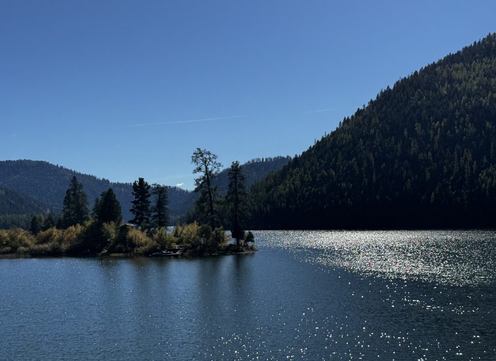
Heading south, we stopped at Swan Lake (of course!), a pristine alpine beauty framed by the Swan Range and the Bob Marshall Wilderness. This 1.5-million-acre preserve, named for conservationist Bob Marshall, is a haven for grizzly bear, elk, and mountain goats, its glacier-carved peaks glowing in the autumn light – a favorite spot for local hunters.
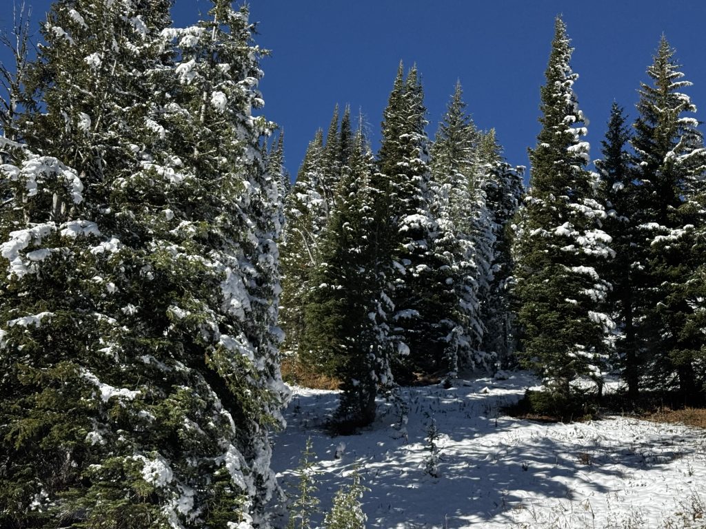
The Flathead and Lolo National Forests lined our route, their lodgepole pines, Douglas firs, and golden larches painting a vibrant scene with lots of Fall colors. Salmon Lake, a quieter stop, shimmered with emerald waters and cottonwood-lined shores.
We cruised through the Bitterroot Valley and Lolo National Forest, tracing part of the 1805 Lewis and Clark Expedition’s Lolo Trail, home to black bear, moose, and bald eagles. Then on to Butte, where we drove past historic mining relics from Butte’s copper-rich days as the “Richest Hill on Earth” in the late 19th century.
We drove south from Butte, passing snow-dusted peaks of the Pioneer, Beaverhead, and Centennial ranges, their white tops contrasting with golden aspens and sagebrush as we crossed into Idaho.
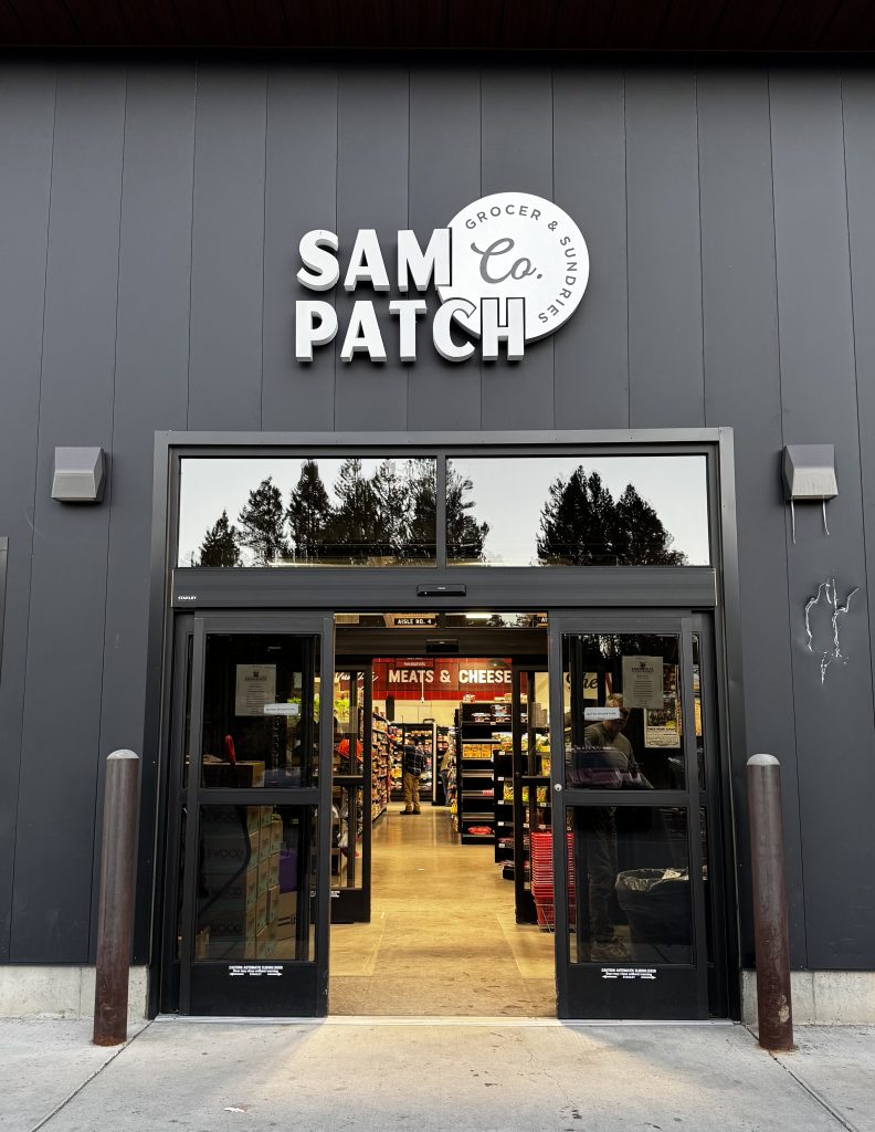
We finally reached Island Park, where we stocked up for tomorrow’s Yellowstone adventure at Sam Patch Co. Grocer, a local staple since 1938 on the Henrys Fork. It’s a perfect spot for fresh produce, meats, snacks, and even fishing licenses for park-bound forays.
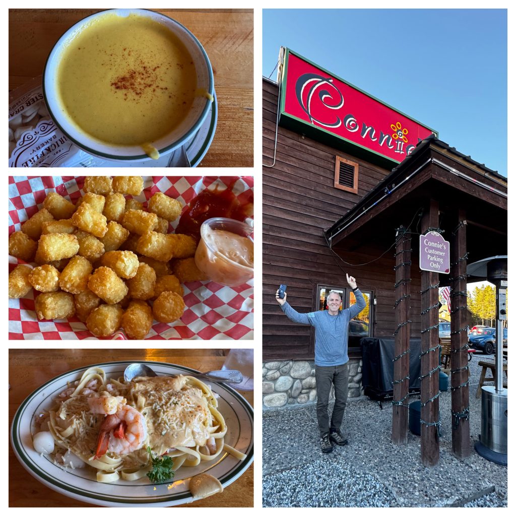
Dinner was at Connie’s Restaurant, a welcoming place with homestyle dishes.
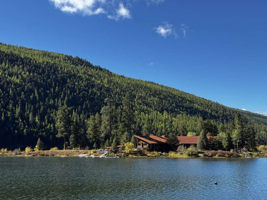
We’re staying at the Marriott SpringHill Suites in Island Park, a very nice hotel – a great base for exploring Yellowstone. Its location, just a short drive from the park’s west entrance, makes it an ideal spot for our planned hikes and wildlife spotting amid bison, wolves, and trumpeter swans.
Island Park sits in a massive volcanic caldera, formed 1.3 million years ago and one of the world’s largest at over 20 miles wide, part of the Greater Yellowstone Ecosystem. The Henrys Fork, a fly-fishing haven, winds through, as do geothermal hot springs.
Today’s 350-mile drive was a breathtaking blend of history, wildlife, and jaw-dropping scenery, with stops at Echo Lake, Swan Lake, Salmon Lake, Butte, and Island Park offering unique slices of the West’s rugged beauty.
Day 2
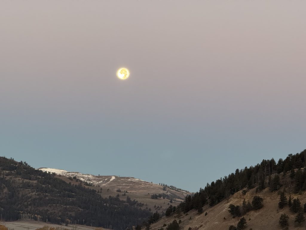
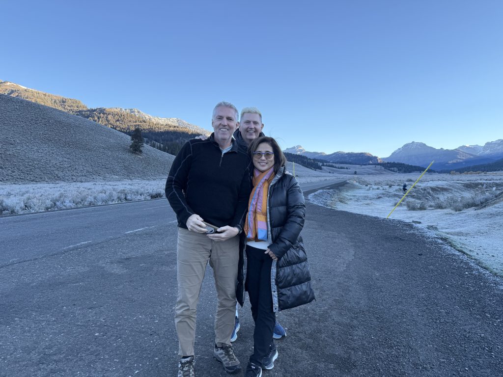
Today we set out from Island Park, Idaho, at 5 AM for our first day at Yellowstone National Park. The drive started pitch black, our headlights barely lighting the frosty road. As we entered the park’s western entrance, we could just make out the faint outlines of snow-capped mountain peaks, like those in the Gallatin Range, in the background. The 30°F cold kept the landscape hidden until we neared Lamar Valley (about 2 hours later), making the journey feel like a leap into the wild unknown.
We hit Lamar Valley, dubbed the “Serengeti of North America,” just before sunrise. The sky glowed with pink, orange, and purple, lighting up the snow-dusted meadows and rugged Absaroka Range peaks, which soar past 10,000 feet.
Sitting at about 6,600 feet elevation, this glacially carved valley is a vast expanse of grasslands and sagebrush steppe, shaped millions of years ago.
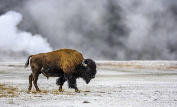
We spotted a black bear foraging not too far away—exciting, given Yellowstone’s 150–200 bear population. Bison herds grazed, part of the park’s 5,000-strong herd, the largest free-roaming group in the U.S.
Pronghorn deer, North America’s fastest land animal (hitting 55 mph), dashed across the frosty grass.
We hiked a short bit of the Lamar River Trail, surrounded by cottonwood trees and willows, with the river supporting cutthroat trout. The park has 10,000–20,000 elk, Lamar is also prime wolf-watching territory since their 1995 reintroduction (about 100 wolves now roam the park), though we didn’t spot any elk or wolves today.
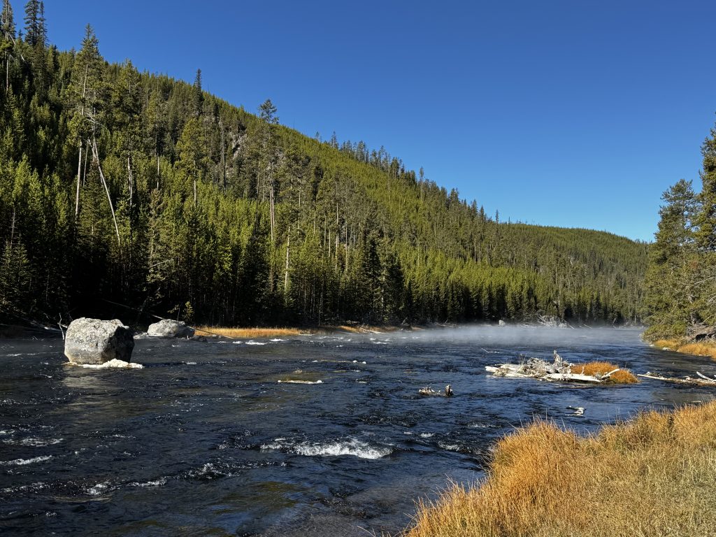
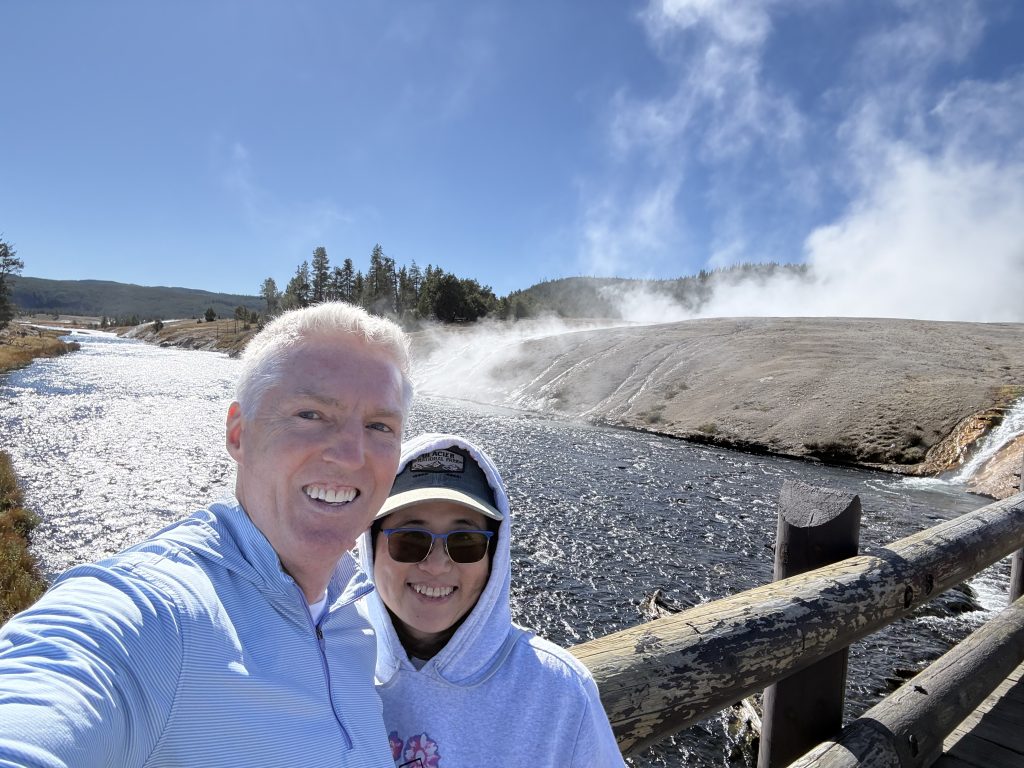
Next, we stopped at the Madison River, a 183-mile lifeline at about 6,800 feet elevation. Its calm waters mirrored the snowy Gallatin Range (peaks up to 11,000 feet). Lodgepole pines and sedges line the banks, home to trumpeter swans and river otters. The Shoshone and other Native tribes fished here for centuries before Yellowstone became the world’s first national park in 1872. It was a peaceful spot for photos and stretching.
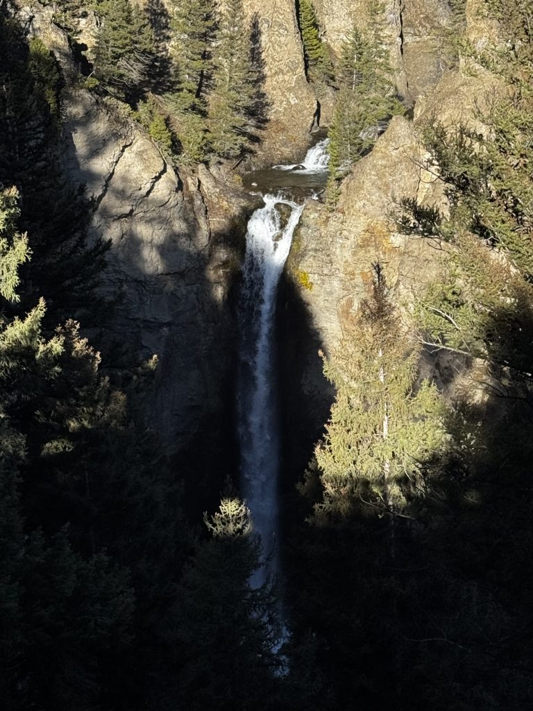
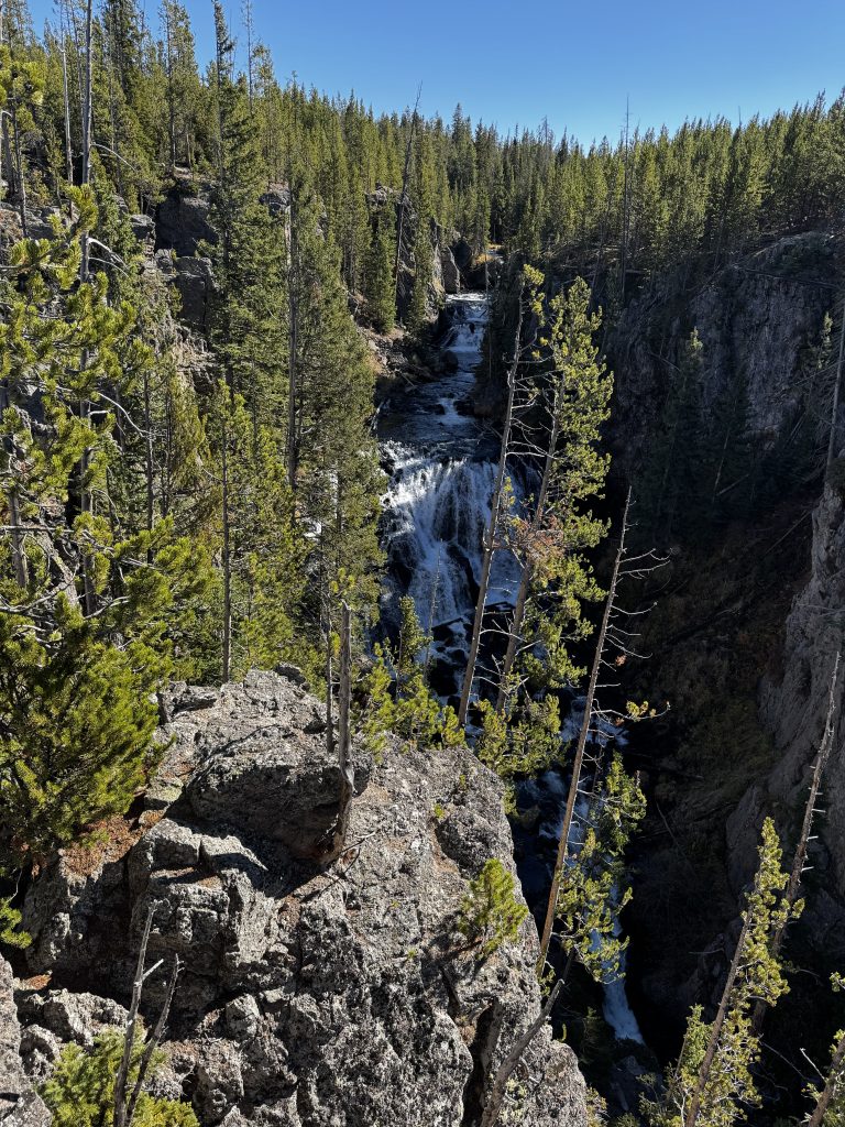
We visited Tower Falls, where the Yellowstone River drops 132 feet over basalt cliffs formed 150,000 years ago by volcanic activity. At roughly 6,500 feet elevation, the area is dotted with Douglas fir and Engelmann spruce forests. A herd of bison strolled right in front of us, making this stop a highlight.
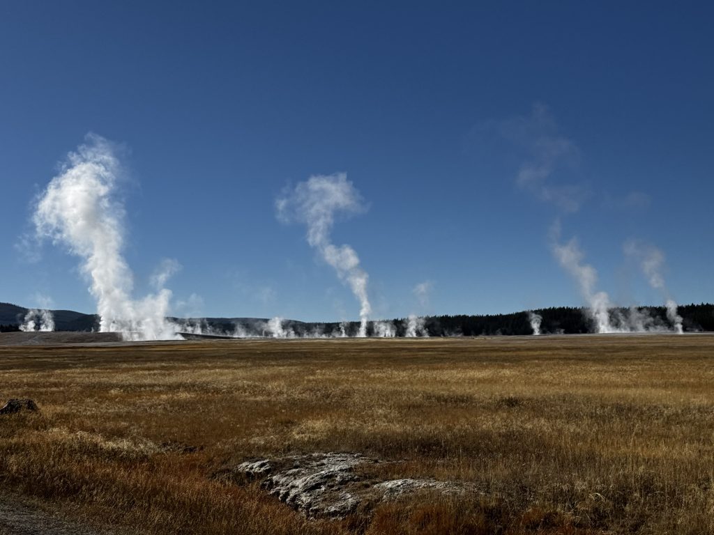
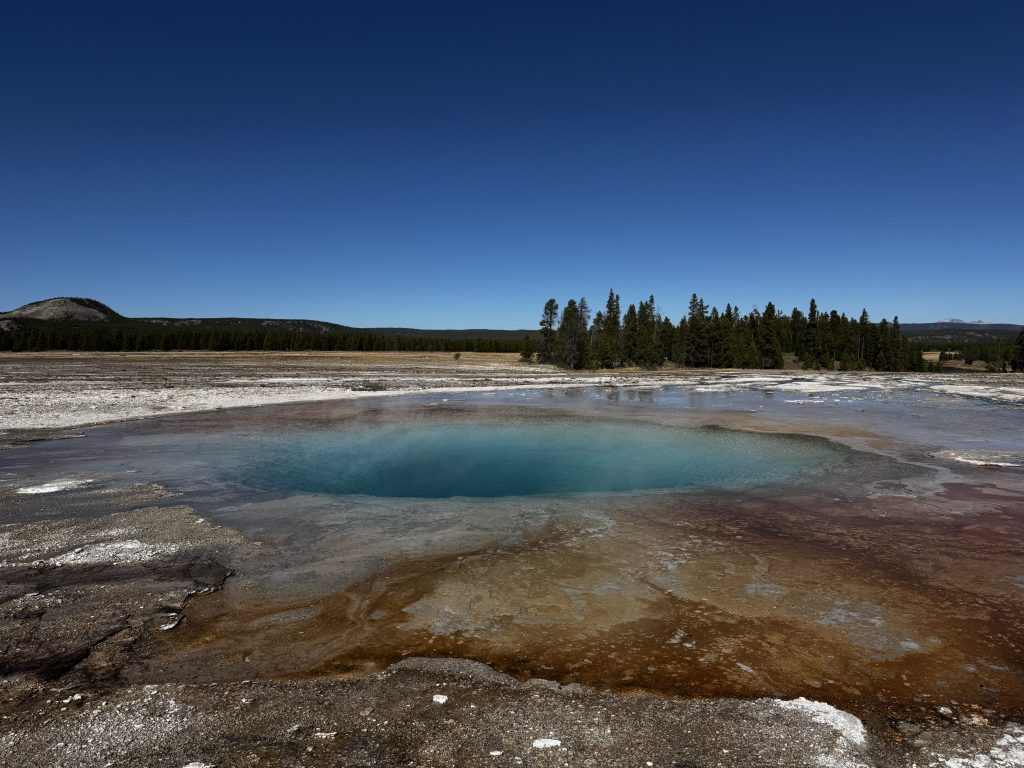
We reached Norris Geyser Basin, home to Steamboat Geyser, the world’s tallest active geyser, capable of eruptions over 300 feet. At 7,500 feet elevation—our highest point of the day, the basin sits on Yellowstone’s super-volcano, last active 640,000 years ago. No major eruption today (they’re unpredictable), but the steaming vents, bubbling mud pots, and colorful microbial mats (from heat-loving thermophiles) were striking. Nearby geothermal pools glowed turquoise, yellow, and orange under the clear fall sky. Yellowstone has over 10,000 geothermal features, making it Earth’s most active hydrothermal area.

In the afternoon, we drove to West Yellowstone for lunch – looking around we spotted “Chinatown” Restaurant, so decided to give it a try. While the name didn’t scream gourmet, the Singapore fried noodles, sweet and sour chicken, fried dumplings, and very spicy, very good Chongqing chicken were surprisingly solid.
West Yellowstone, a gateway town since the park’s early tourism days in the 1900s, sits at 6,667 feet amid lodgepole pine forests. Yellowstone’s topography is a mix of volcanic plateaus, river valleys, and mountain ranges, with elevations from 6,000 to over 11,000 feet. Our route hit a high of 7,500 feet at Norris, with Lamar Valley’s open plains, the Madison’s broad valley, and Tower’s rugged cliffs showcasing the park’s diversity. The scenery—snow-dusted peaks, golden aspens, and steaming geothermal areas—was stunning, shaped by millions of years of volcanic and glacial activity.
The park’s flora includes lodgepole pines (covering 80% of forested areas), sagebrush, and willows, with wildflowers like lupine fading by fall. Fauna is rich: besides our bear, bison, and pronghorn sightings, Yellowstone hosts 67 mammal species, 300+ bird species, and 16 fish species. The park’s role in saving bison and reintroducing wolves is a conservation success story.
We drove back to Island Park by mid-afternoon, passing more snow-dusted peaks and golden aspens. The day was incredible, from the dark drive with barely visible mountains to Lamar’s sunrise and Yellowstone’s wildlife and geology.
Tips for Travelers: The pre-dawn drive is dark—those peaks are just shadows. Hit Lamar Valley for sunrise (to ensure good parking) and bring binoculars for wildlife (that bear was a treat). Check http://nps.gov/yell for road conditions, as snow can make roads slippery. Wear layers for 30°F mornings, and don’t miss Steamboat Geyser at Norris. Chinatown in West Yellowstone is worth a stop—get the Chongqing chicken if you like spice. Yellowstone was amazing today!
Day 3
We began our day in West Yellowstone, entering the park via Highway 191, which runs across a high plateau at roughly 7,900 feet elevation. The terrain includes volcanic calderas, canyons shaped by rivers, and open meadows with peaks exceeding 10,000 feet, all resulting from eruptions about 640,000 years ago.
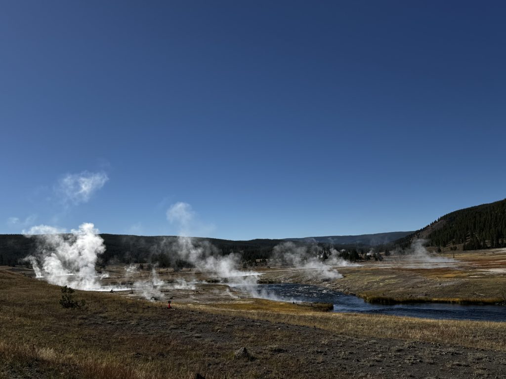
Our first stop was the Firehole River in the Lower Geyser Basin for a short hike along the banks, passing through cottonwoods and willows in fall colors. Named for steam from nearby hot springs, the river stays warm in spots from geothermal sources.
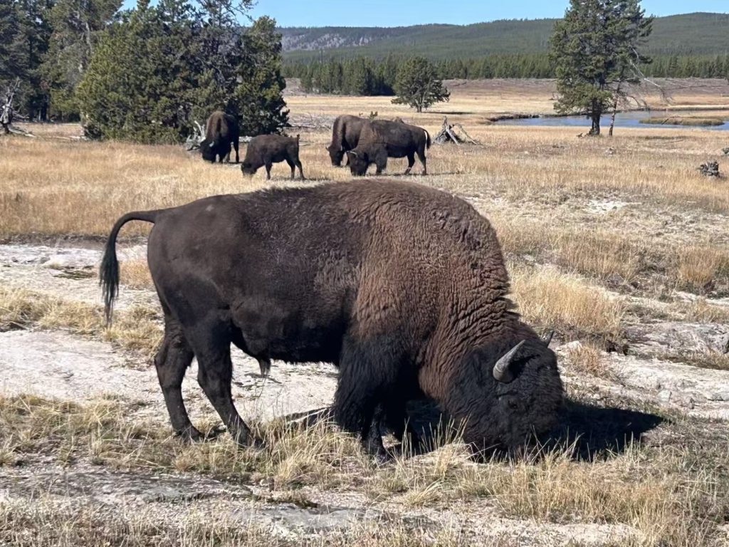
Midway through, some of our group walked into a herd of about two dozen bison, including several small calves.
Yellowstone maintains around 5,900 bison across central and northern herds; this group belonged to the central herd that roams the Firehole and Madison regions year-round. Adults can weigh up to 2,000 pounds, so we kept distance to avoid any charges—it’s the only continuous bison population in the U.S. from prehistoric times.
We continued to overlook pullout for Grand Prismatic Spring in the Midway Geyser Basin.
This is the park’s largest hot spring, spanning 200 to 330 feet wide and over 121 feet deep, making it one of the world’s biggest after sites in New Zealand and Japan.
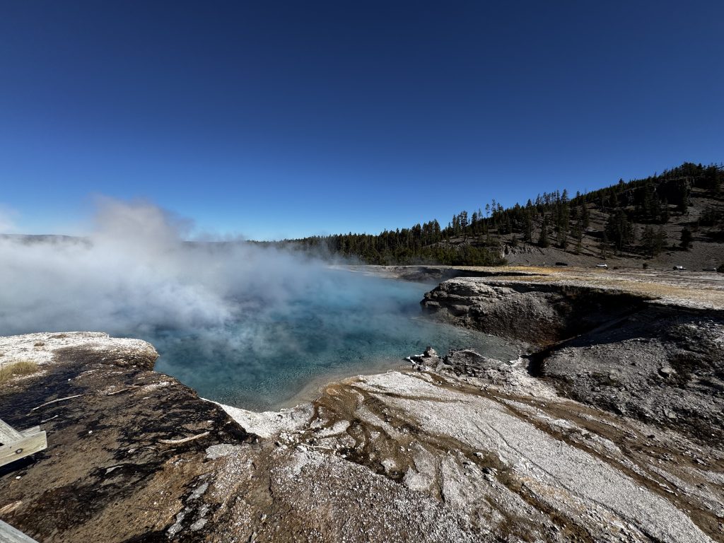
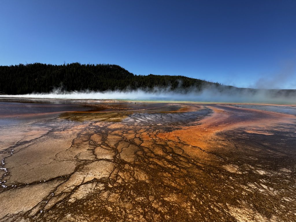
From the elevated boardwalk, we saw a central deep blue pool transitioning to vivid yellows, oranges, and reds at the edges, created by heat-tolerant bacteria and algae that change color based on water temperatures from 160°F downward.
Up close on the lower boardwalk, bubbling sounds and humid air add to the immersion, with water flowing at 560 gallons per minute.
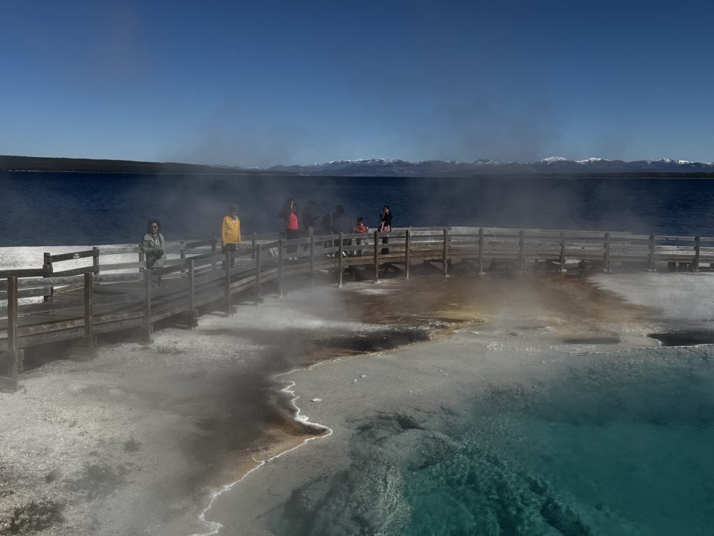
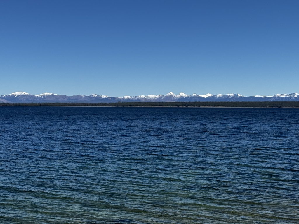
Moving south, we visited the West Thumb Geyser Basin along Yellowstone Lake, the largest high-elevation lake in North America at 7,733 feet above sea level. This area features more than a dozen hot springs, mud pots, and fumaroles right on the lakeshore, shaped by lava flows within the park’s caldera and glacial processes. The lake itself spans 136 square miles and drops to 400 feet deep in a volcanic basin, with underwater vents producing patches of turquoise water amid the clearer blue expanse.
In early October, the scene was striking: the calm waters and the autumn foliage along the edges, with a beautiful backdrop of snow-capped mountains like Avalanche Peak. The boardwalk passes sites like Fishing Cone, once used to boil lake fish directly—now off-limits for safety.
On the way to Old Faithful, we stopped at Kepler Cascades, an added bonus to our Yellowstone adventure. This cascading waterfalls on the Firehole River in southwestern Yellowstone National Park, Wyoming, drop a total of about 150 feet (46 meters) over multiple tiers, with the tallest single drop measuring 50 feet (15 meters). Absolutely breathtaking! The cascades were first documented by the 1870 Washburn-Langford-Doane Expedition and named in 1881 by park superintendent Philetus Norris after Kepler Hoyt, the 12-year-old son of Wyoming’s territorial governor, during their park tour.
We arrived at Old Faithful for the predicted 4pm eruption, which hit within 10 minutes, sending water nearly 200 feet high.
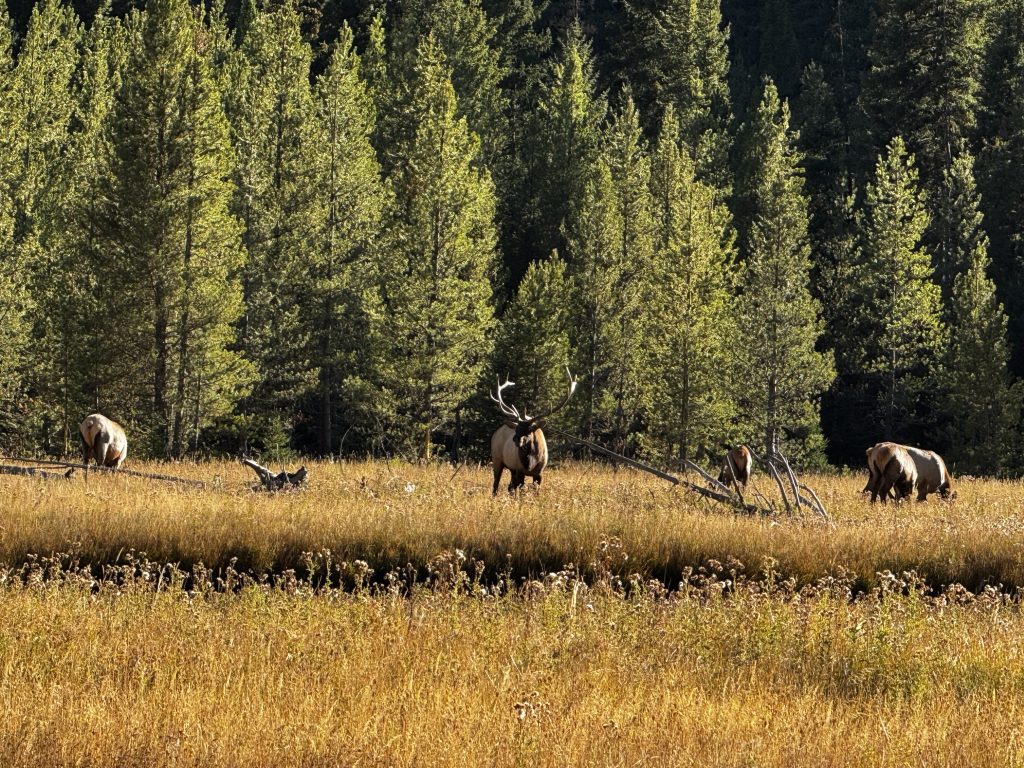
Exiting back through the West Entrance, we paused by the Madison River to watch an elk herd from the Madison-Firehole group.
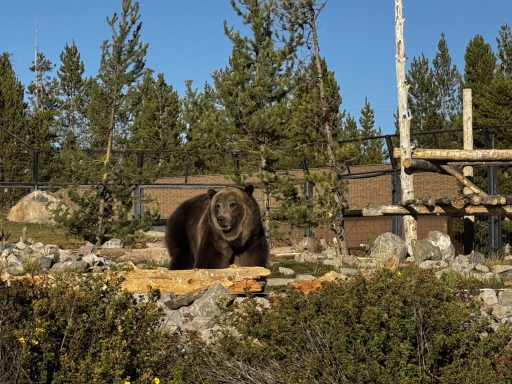
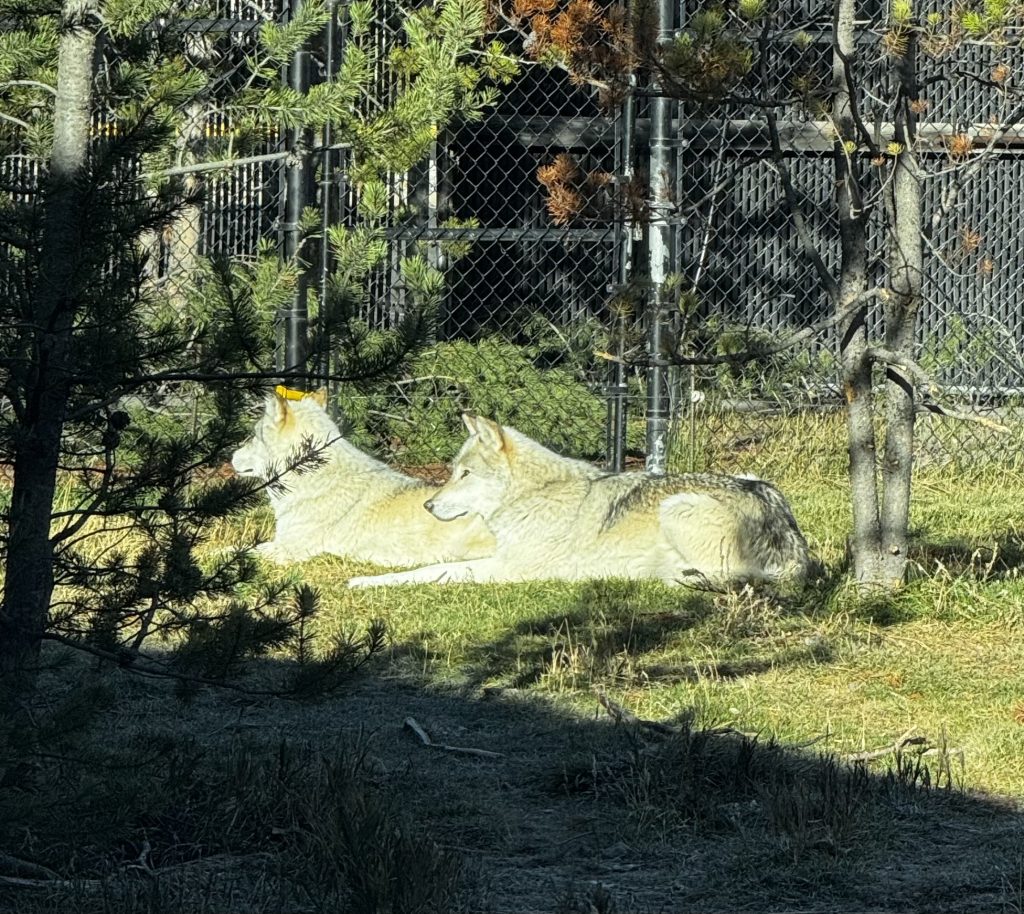
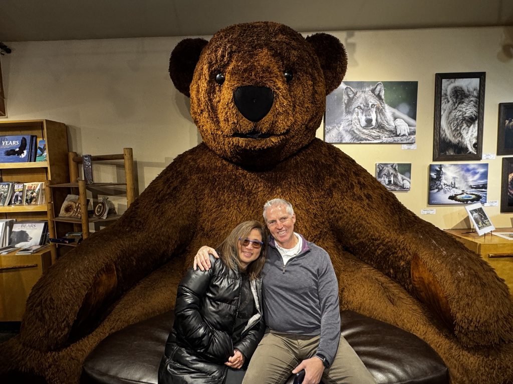
Outside the park, we stopped at the Grizzly and Wolf Discovery Center in West Yellowstone, a rescue site with grizzlies and wolves in large enclosures, plus indoor exhibits on conservation, where we saw 2 magnificent male grizzlies and 2 beautiful gray wolves.
We wrapped up with dinner right next door at Park One Chinese Restaurant – large portions of dishes like General Tso’s chicken and curry fried noodles.
The day’s geothermal sites and wildlife encounters, linked by the park’s volcanic landscape, provided a solid mix of sights and nature. Ready for one more swing through Yellowstone tomorrow on the way to Grand Teton!
Day 4
Today’s road trip from Yellowstone to Wyoming was incredible! Another pass through Yellowstone National Park, then on to the epic Teton Range, and Grand Teton National Park, loaded with unreal views, wildlife, a memorable lunch, and some deep history.
We started in Island Park, Idaho, at about 6,300 feet in a massive volcanic caldera—one of the largest on Earth. Driving south on US-191/20, we stopped again at the Bear/Wolf Discovery center to see if the wolves were awake today (they were sleeping last night when we went), and they were, amazing creatures for sure.
We then passed back through Yellowstone, landscape shifting from forested plateaus to rolling hills with geothermal action.

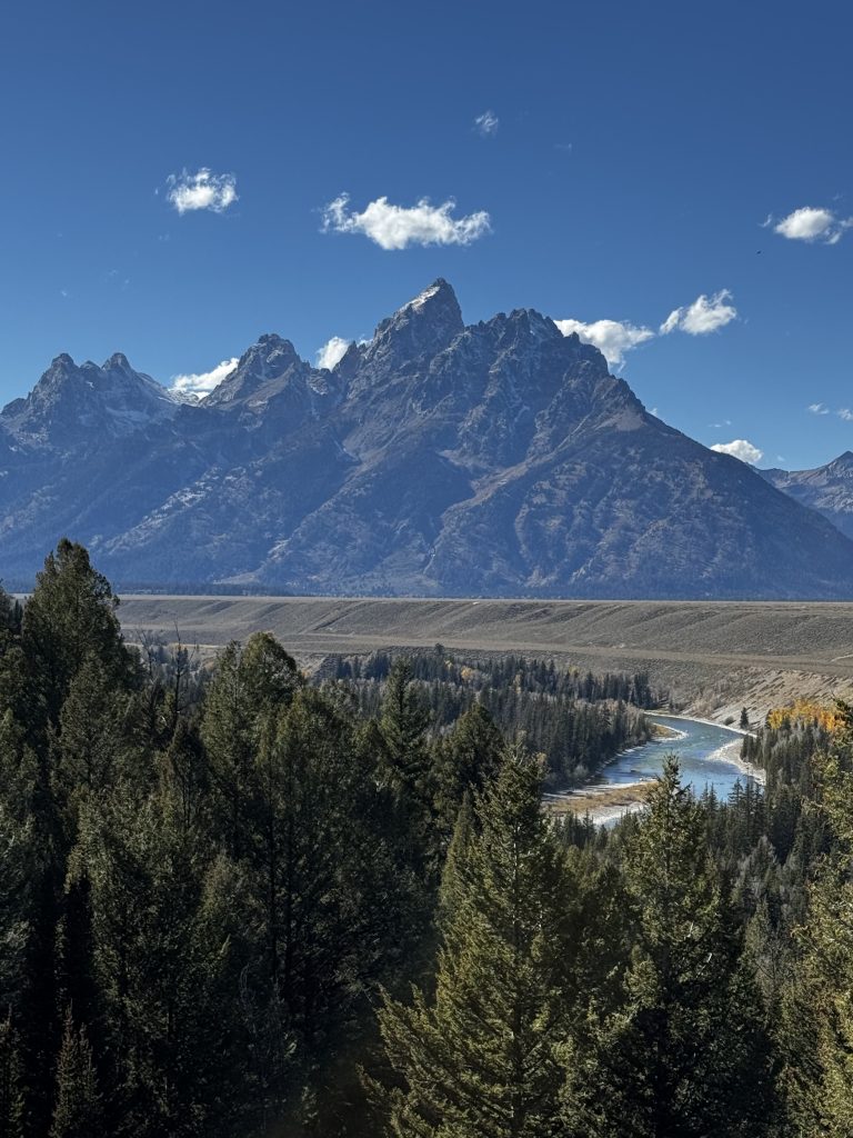
Exiting Yellowstone, we hit the Teton Range, where the scenery got intense. The Tetons, formed by fault-block uplift around 9 million years ago, are young, steep, and rugged. In Grand Teton National Park, the Snake River winds through the valley, framed by those iconic peaks.
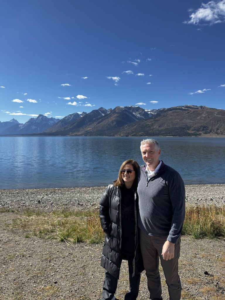
Our first stop was Jackson Lake Overlook, where the Grand Teton (13,775 feet) and its neighbors loomed large, reflecting in the lake under clear skies.
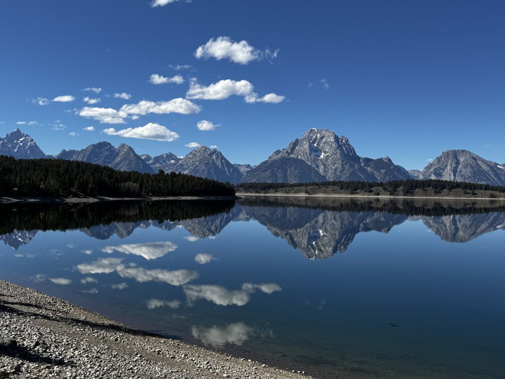
On the south part of Jackson lake (right before Signal Mountain turnoff), we stopped at a pullout spot that was straight-up magical. The water was dead calm, mirroring the entire Teton Range perfectly—a postcard moment that felt like the most incredible thing ever. We stood there, totally floored at the majesty of God’s creations.
For lunch, we hit Trapper’s Grill, grabbing a table right by the window with Jackson Lake and the Tetons staring us in the face. The food was very good, portions very large: the elk/bison/beef chili was hearty and flavorful, the trout tacos were fresh and zesty, the Lumberjack Burger was a juicy beast, and the chicken quesadillas were perfectly cheesy. Eating with that view made it even better.
Post-lunch, we stopped at Oxbow Bend along the Snake River, a wildlife magnet. The slow, curving river and Mount Moran’s backdrop are a photographer’s dream, and we spotted a herd of antelope grazing nearby.
Then, at Snake River Overlook, we took in the view Ansel Adams immortalized in 1942, with the river cutting through the valley and the Tetons dominating.
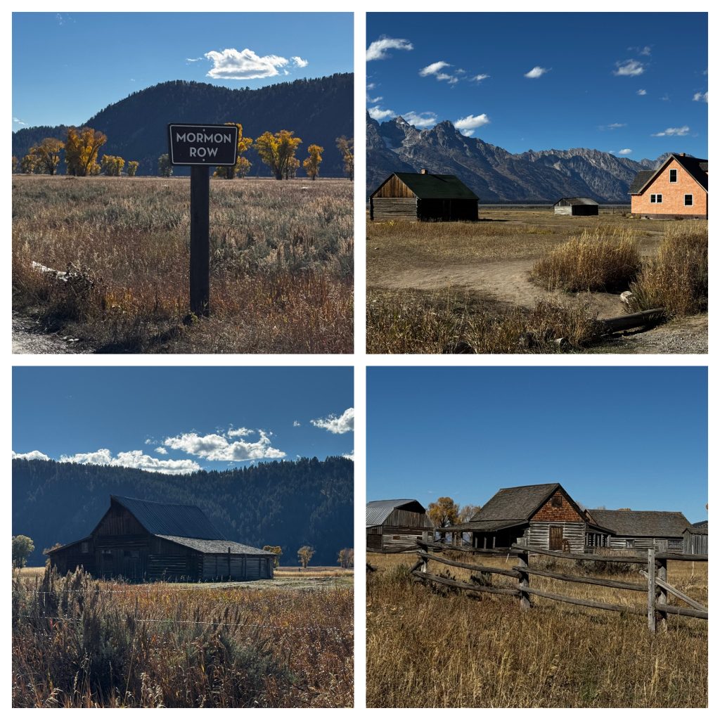
Next we detoured east on Antelope Flats Road to Mormon Row, a historic spot that’s got a rich backstory. Originally called Grovont after the nearby Gros Ventre River, it was settled in the late 1890s by about 27 Mormon families from the Salt Lake Valley area, drawn by the Homestead Act of 1862. That law let anyone over 21 (or head of household) claim 160 acres of public land for free if they built a house and farmed it for five years—perfect for these folks seeking fertile land in Jackson Hole for crops like oats, barley, and hay, plus ranching cows and horses. They clustered their homesteads together for mutual support, building a tight-knit community with a church (from 1916, now relocated but marked by trees) and a school. Life was brutal, though—short growing seasons, harsh winters, and isolation took a toll.
Key families included the Moultons (John and T.A., with their famous barns), Andy Chambers, and others like Joseph Eggleston and Henry May. By the mid-1900s, economic pressures and park expansion led most to sell out; John Moulton hung on with a life lease until he died at 103 in 1990, and the last private plot went to the park in 2018. The National Park Service, with help from the Grand Teton National Park Foundation, preserved the remaining six building clusters (like the Moulton and Chambers barns and the iconic pink stucco house) starting in the 1990s. The whole district hit the National Register of Historic Places in 1997, and a $7 million Mormon Row Initiative since 2021 is fixing them up for longevity, even adapting some for park employee housing while keeping public access.
Right before getting to Mormon Row, we spotted a huge bull moose, its massive antlers swaying as it chowed on willows.
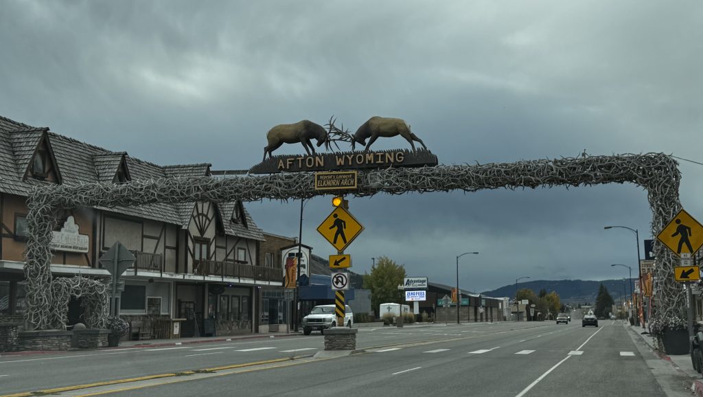
Continuing south, we passed through the Lewis River Canyon, where the road hugs cliffs carved by glaciers and rivers, with the Lewis River rushing below. We wrapped the day in Afton, Wyoming, a small town in Star Valley at about 6,200 feet, famous for its giant elk antler arch made from over 3,000 antlers.
The 150-mile drive dished up volcanic plateaus, towering mountains, river valleys, and open plains. The Jackson Lake reflection, that moose sighting, Mormon Row’s pioneer tales, and good food at Trapper’s Grill’s with the Tetons as a backdrop were the day’s highlights. We’re crashing in Afton tonight, looking forward to tomorrow when we drive south to Utah. A great day!